VR Data Mapper
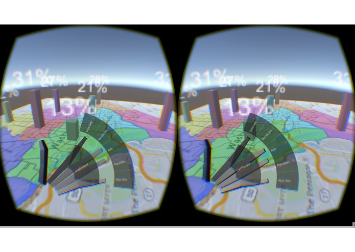
At Bitcamp 2015 my team worked to find a way to best display open source data from the DC government using VR technology. This project allows a user to observe a map of Washington DC’s wards through an Oculus rift and display a number of geographically impacted datasets on the map.
By using the Leap Motion, we were able to integrate hand gestures and sophisticated menus, simplifying complex operations and allowing users to focus on exploring the data before them.
The biggest take away from the project was how different VR experiences feel. Although none of the information we presented required Virtual Reality to engage with, there was a decisively more tangible dimension to being surrounded by geospatial data as opposed to merely a detached observer.